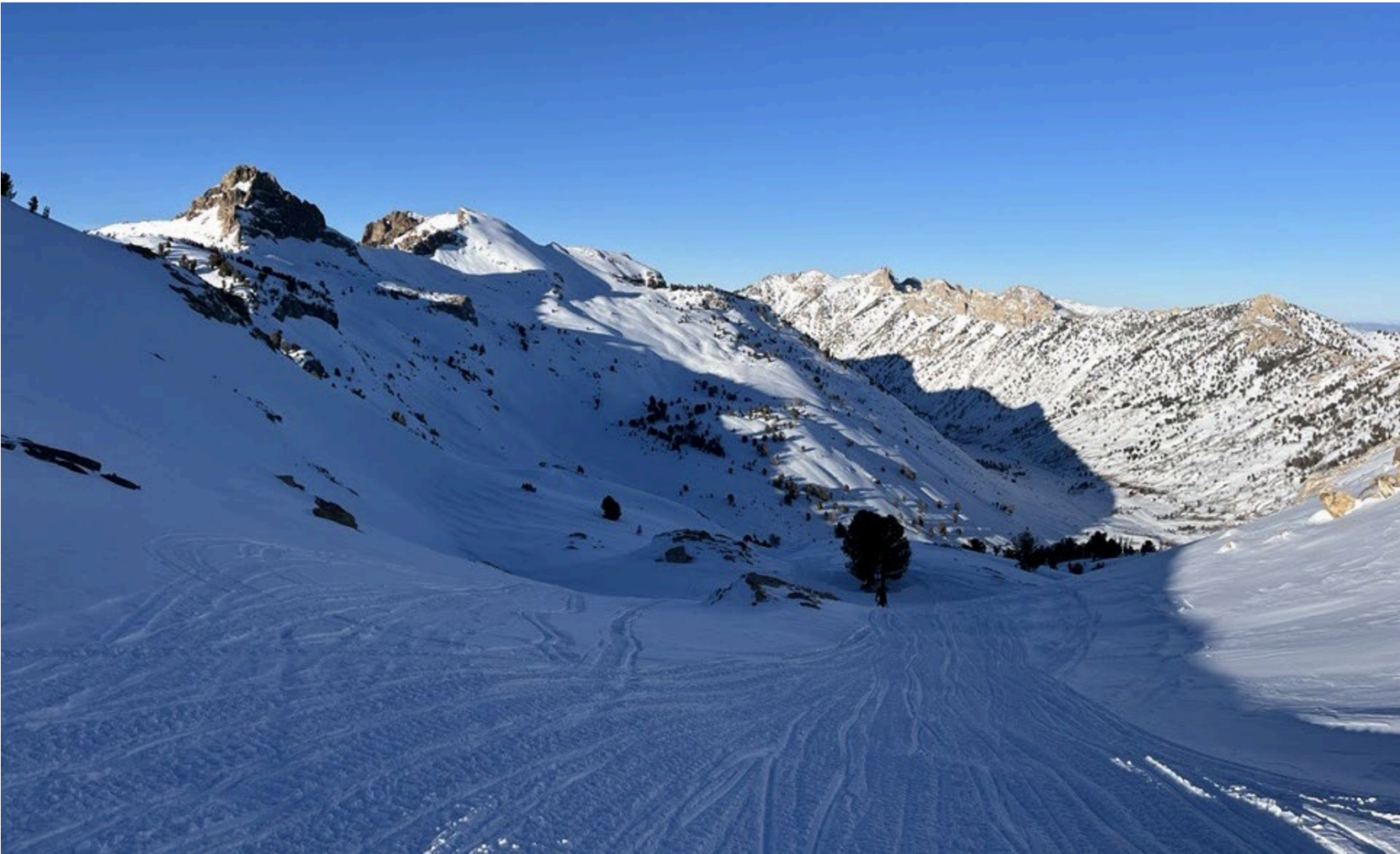
Nevada’s Ruby Mountains in January. (Photo: Spencer Dondovan for USDA Natural Resources Conservation Service.)
A strong Pacific storm system brought flooding rains to California and heavy snow to the Sierra Nevada, but drought concerns continue for Nevada as persistent dry and warm temperatures cut into the state’s snowpack.
February brought the first atmospheric river of the winter into the Sierra, and while the storm system improved conditions significantly it has not produced enough snow to recover from Nevada’s poor January conditions.
Lack of snow and precipitation in earlier winter months has decreased the likelihood of an average water year for Nevada, said Thomas Albright, the interim Nevada State Climatologist.
“We had a very dry start,” Albright said. “We’ve got a lot of ground to make up. It’s not that it couldn’t happen. But we’ve got about half the season behind us. So we’d have to have a really big end of the season.”
Up until the start of February the snowpack in Tahoe Basin and the surrounding Sierra mountain range, an important water source for the Truckee River and the Reno-Sparks area, was “anomalously low,” said Albright. Chances of snowpack reaching a median peak in the Sierra are now only about 2 in 10 based on historic data, according to the U.S. Department of Agricultural Natural Resources Conservation Service’s winter outlook report. Low snowfall in the Sierra through January also resulted in western Nevada, including the Reno-Sparks area, slipping into “abnormally dry,” a precursor to drought.
While the region is “way behind” in terms of precipitation and snow, powerful atmospheric rivers this month helped make up some ground. Snowpack in the Sierra Nevada is now around 60 to 75% of average, a vast improvement from the 50% of average seen in January.
“So instead of being kind of a really horrible winter, now we’re just in a merely dry one,” Albright said.
There’s a lot to be optimistic about when it comes to Nevada’s water outlook this year, said Albright. Climate models for the state show potential for additional large storms in the near future.
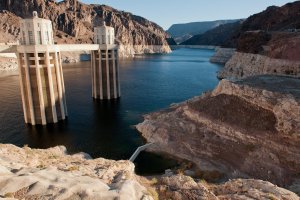
In February, snowpack in the Upper Colorado River basin — the primary water source for the Colorado River and Lake Mead — also reached normal levels for the first time in 2024, after starting the year with some of the lowest early January snowpack levels in history, according to the USDA.
In Southern Nevada, the Spring Mountains outside of Las Vegas received a deluge of rain and snow in February, resulting in an above average snowpack.
Reservoir storage is better than this time last year across the state. The volume of streamflow produced from last winter’s record snowpack has allowed reservoir managers to carry over significant storage amounts into 2024.
Snowpack, precipitation, and streamflow forecasts for other parts of Nevada are also well above normal, including for the Northern Great Basin, and the Humboldt, Owyhee, Snake and Clover-Franklin basins. Valley precipitation totals were also near normal in western Nevada and well above normal in Winnemucca, Elko and Ely.
Climate models show Nevada may even benefit from additional atmospheric rivers in the near future, said Albright. While encouraging, he warned that final snowpack totals across the region in April will ultimately determine the state’s water year.
“I’m pretty optimistic that we’ll avoid the worst conditions,” Albright said. “It’s at least not looking terribly severe.”
Dry January followed record December warmth
One thing working against Nevada’s snowpacks is the state’s abnormally warm temperatures this winter, said climate scientists. New record high daily temperatures were recorded across Nevada towards the end of January. Reno saw a record of 69 F on January 28. On January 29, Eureka set a record of 59 F and Las Vegas set a record of 72 F.
Heat waves can easily shrink snowpack, a natural water storage system, melting snow before it can be used in the drier summer.
December in Nevada was even warmer overall, said Daniel McEnvoy, a researcher for the Western Regional Climate Center.
“The monthly departure in Reno was 3.8 degrees Fahrenheit above average, that’s a substantial anomaly for a monthly average,” McEnvoy said, adding it was the third warmest December on record for Reno.
In Las Vegas, the monthly average was 5 degrees Fahrenheit above average for the month of December. Across the U.S, the average temperature in December was 7.3 degrees Fahrenheit above average, making it the warmest December in the 129 years of record-keeping, according to the National Oceanic and Atmospheric Administration.
“You can really notice that in the snowpack. Last year was pretty exceptional, but the big difference last year was that there was a lot more snow at lower elevations. Whereas this year, there’s really not that much snow at all at the lower elevations in the mountains,” McEnvoy said.
Seasonal snow cover across lower elevations replenishes soil moisture and provides water for plant growth. While atmospheric rivers from the Pacific Ocean did improve snow cover in Nevada from February to January, there is still little snow at lower elevations across the state at this time.
“It was great to have those storms and it did make a dent in the deficit, but it didn’t completely make up the deficit from the dry months that we had prior to that,” McEnvoy said.
A climate phenomenon known as El Nino has created warmer than normal atmospheric conditions this year, but warmer baseline temperatures in the Pacific Ocean are also contributing to warmer winter temperatures in Nevada, McEnvoy said. That may be the new normal for the west coast due to climate change.
“In general, we are just kind of expecting conditions to generally be warmer than they were in the past,” McEnvoy said.
Abnormalities in snowpack can become a challenge for water managers in the state, said Albright.
At the start of February, Nevada’s Ruby Mountains had more snow than the Eastern Sierra, an important water source for the Truckee River and the Reno-Sparks area. The unusual distribution of snow and precipitation was an example of the difficulties Nevada’s water managers may face come spring, said Albright.
“Snowpack is above average in the northeastern part of the state. These are ranges that don’t have massive amounts of water to contribute and aren’t as influential to our regional water supply,” Albright said.
“That’s important for folks that are using the water locally, but the Sierra drives the water supply story in Northern Nevada and the Upper Colorado drives the story in Southern Nevada.”
Our stories may be republished online or in print under Creative Commons license CC BY-NC-ND 4.0. We ask that you edit only for style or to shorten, provide proper attribution and link to our website. AP and Getty images may not be republished. Please see our republishing guidelines for use of any other photos and graphics.